
Introduction
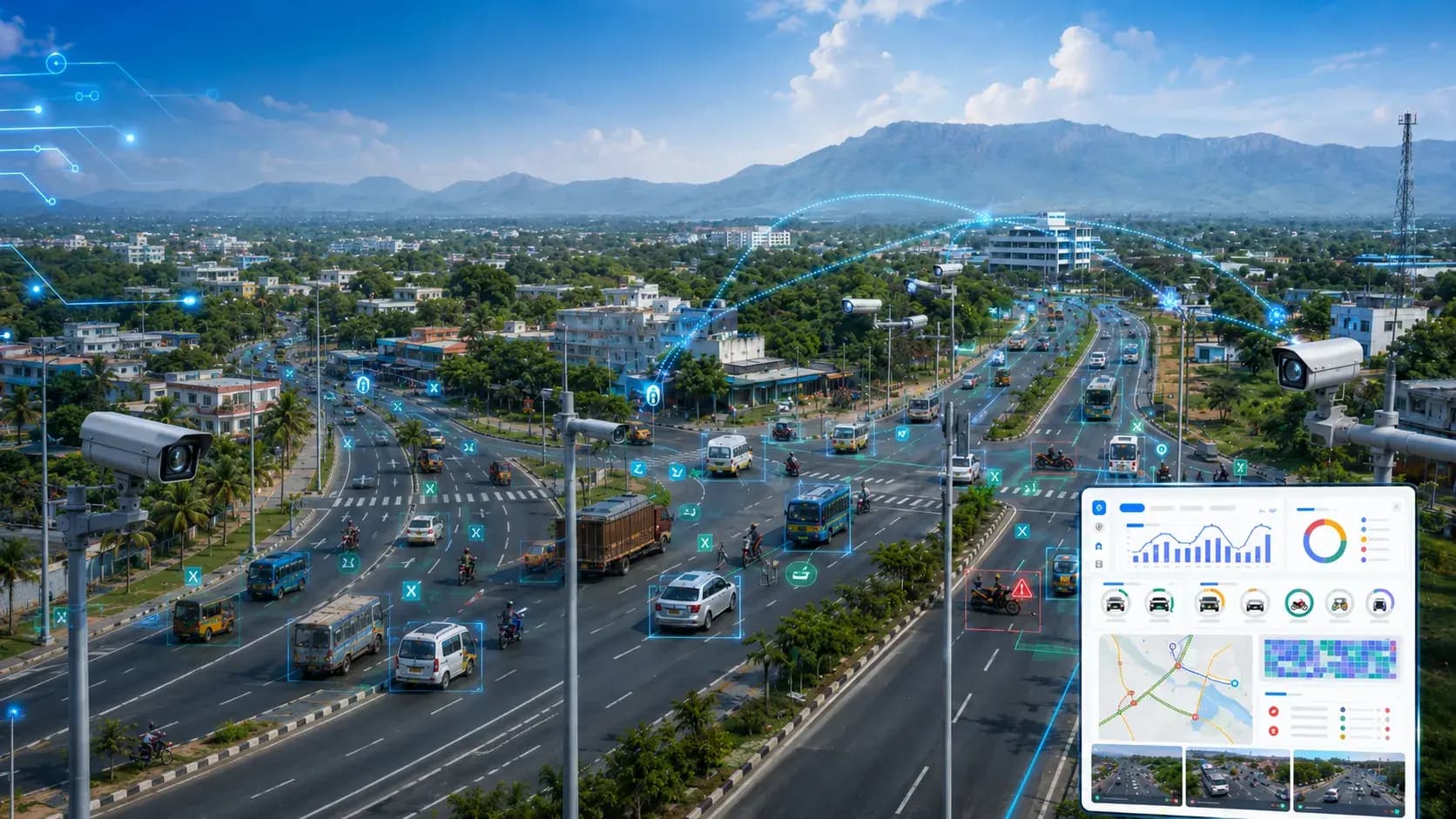
- Managing traffic across a large road network requires more than conventional CCTV surveillance. Traffic authorities need continuous visibility, automated violation detection, accurate vehicle identification, reliable speed monitoring and quick access to incident evidence.
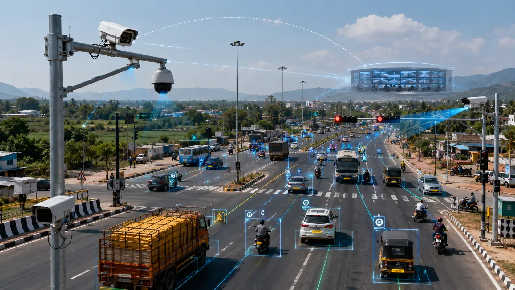
- Katomaran Technologies implemented an AI-powered Traffic Management System across approximately 40 km in Theni district, Tamil Nadu. The project integrated 33 strategically positioned cameras across major transport hubs, administrative areas, bypass roads and high-traffic junctions.
- The solution combined AI video analytics, Automatic Number Plate Recognition, sectional speed measurement, vehicle tracking, traffic violation detection, incident monitoring and centralized video management.
- Instead of using cameras only to record road activity, the system continuously analyzed traffic footage and generated actionable events whenever a configured violation, vehicle or incident was detected.
- This transformed the camera network into an intelligent traffic monitoring platform capable of supporting traffic enforcement, road safety and data-driven traffic management.
Project at a Glance
- 1Project location: Theni district, Tamil Nadu
- 2Road coverage: Approximately 40 km
- 3Cameras deployed: 33
- 4Key monitoring locations: 9 major traffic points
- 5Solution: AI-powered Intelligent Traffic Management System
- 6Vehicle identification: Automatic Number Plate Recognition
- 7Speed monitoring method: Sectional speed measurement
- 8Monitoring approach: Centralized live and recorded video monitoring
- 9Primary capabilities: Traffic violation detection, vehicle analytics, speed monitoring, incident detection and evidence management
Key Traffic Monitoring Locations
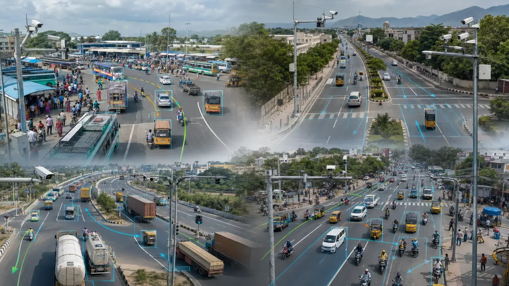
- The 33-camera network was deployed across strategically important locations within Theni district.
- The major monitoring points included:
- 1Theni Bus Stand
- 2Theni District Collectorate
- 3Cumbum Bypass Junction
- 4Vilakku Junction
- 5Gandhi Statue Junction
- 6Annaji Junction
- 7Thappukundu Junction
- 8Vadugapatti Junction
- 9Chinnamanur Junction
These locations represented a combination of busy public transport areas, administrative zones, important junctions, bypass connections and road entry and exit points.
Each camera location was planned according to its traffic environment and monitoring objective. Some cameras focused on number plate recognition and vehicle movement, while others supported violation detection, traffic observation, incident identification or sectional speed measurement.
Connecting all these locations to one centralized platform provided traffic operators with unified visibility across the entire monitored corridor
The Traffic Management Challenge
- Monitoring a 40 km road corridor manually creates significant operational challenges. The road network includes varying traffic conditions, vehicle speeds, road layouts and movement patterns. Busy junctions may experience congestion and traffic violations, while open road sections require speed monitoring and incident detection. Even when CCTV cameras are available, operators cannot continuously observe every feed and identify every violation in real time.
- The project needed to address several important requirements:
- 1Monitor traffic activity across a long road corridor
- 2Centralize video feeds from multiple locations
- 3Detect traffic violations automatically
- 4Identify vehicles using number plate information
- 5Measure vehicle speed across selected road sections
- 6Track vehicle movement between monitoring points
- 7Detect accidents, stopped vehicles and road obstructions
- 8Monitor traffic congestion and vehicle density
- 9Count and classify different vehicle categories
- 10Generate visual evidence for detected events
- 11Reduce dependence on continuous manual observation
- 12Maintain searchable traffic and vehicle records
The solution also needed to remain scalable so additional cameras, analytics and monitoring locations could be integrated in the future.
Katomaran Technologies’ Solution
- Katomaran Technologies developed an integrated traffic monitoring solution built around its Intelligent Traffic Management System. The implementation began with an assessment of the road corridor, traffic patterns, junction layouts and critical monitoring requirements.
- Camera locations and viewing angles were selected based on:
- 1Road direction and lane visibility
- 2Vehicle approach and departure paths
- 3Number plate capture requirements
- 4Distance between speed-monitoring points
- 5Traffic density at junctions
- 6Available installation infrastructure
- 7Required AI detection capabilities
The 33 cameras were then integrated into a centralized monitoring environment. AI analytics were configured according to the operational purpose of each camera. The complete solution included: AI-powered video analytics, Automatic Number Plate Recognition, sectional speed measurement, vehicle tracking, traffic violation analytics, and Centralized live video monitoring. This integrated approach allowed the system to identify relevant traffic activity automatically instead of depending entirely on manual camera observation.
AI Video Analytics for Proactive Traffic Monitoring
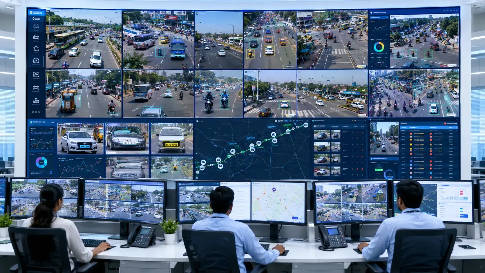
- AI video analytics formed a major part of the Theni Traffic Management System. The analytics engine processed live camera feeds and identified vehicles, traffic behaviour, violations and roadway incidents based on configured rules.
- When the system detected a relevant event, it generated an alert containing available details such as:
- 1Detection category
- 2Camera name
- 3Monitoring location
- 4Event date and time
- 5Vehicle image
- 6Number plate image
- 7Vehicle category
- 8Direction of movement
- 9Event snapshot
- 10Supporting video clip
This allowed operators to focus on important events rather than continuously monitoring all 33 camera feeds. The system also helped transform unstructured CCTV footage into searchable and organized traffic information.
Sectional Speed Measurement
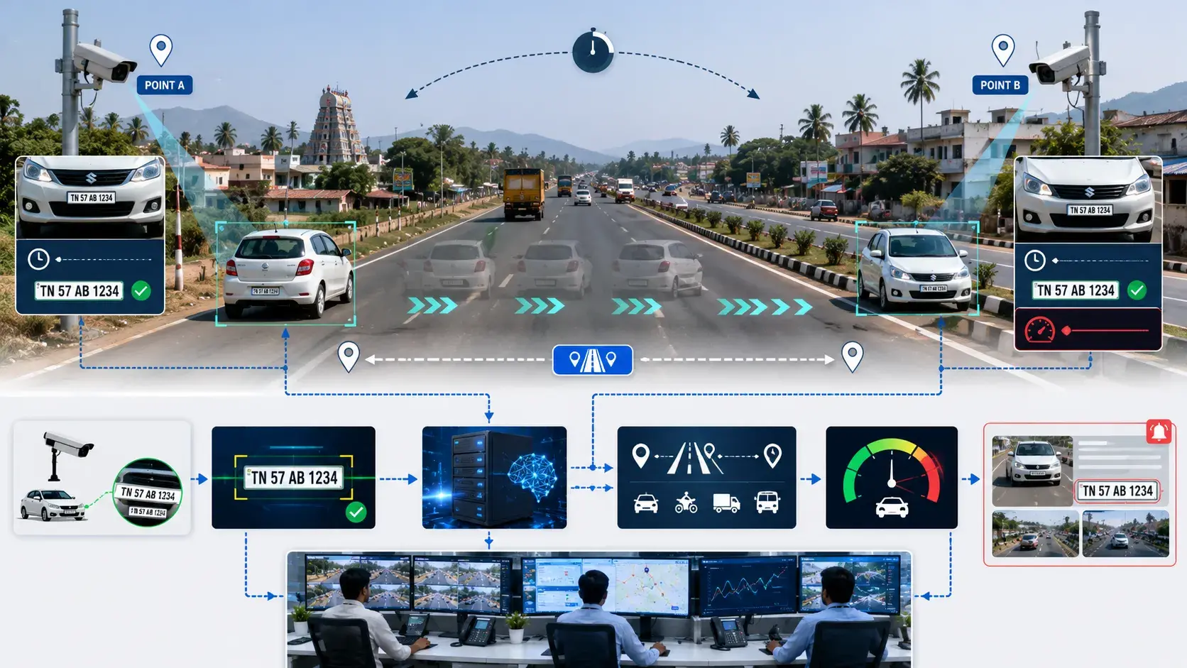
- One of the key technologies used in the Theni project was sectional speed measurement. Unlike conventional point-based speed detection, which measures speed at one location, sectional speed measurement calculates a vehicle’s average speed between two predefined monitoring points. This method provides speed monitoring across a longer section of the road.
- How Sectional Speed Measurement Works:
- When a vehicle passes the first monitoring point, an ANPR-enabled camera captures the vehicle and records the vehicle number plate, entry date and time, entry camera location, vehicle image, and direction of travel. When the same vehicle reaches the second monitoring point, another camera captures the number plate and exit timestamp.
- The Traffic Management System matches the number plate records from both locations. It then calculates the time taken by the vehicle to travel the known distance between the two camera points.
- The sectional speed workflow follows this process:
- Vehicle Detected at Entry Point → Number Plate Captured → Entry Time Recorded → Vehicle Detected at Exit Point → Number Plate Matched → Travel Time Calculated → Average Speed Determined → Violation Event Generated
- When the calculated average speed exceeds the configured speed limit, the system generates an overspeeding event with entry/exit images, number plate crop, timestamps, and locations as supporting evidence.
- Sectional speed measurement helps discourage drivers from slowing down only near individual speed cameras and accelerating again after passing them. It supports more consistent speed compliance across the monitored road section.
Automatic Number Plate Recognition
- Automatic Number Plate Recognition was used to identify vehicles and convert registration plates into searchable digital records.
- When a vehicle passed an ANPR-enabled camera, the system captured the vehicle image, detected the number plate and associated the record with the relevant location, date and time.
- ANPR supported several important project workflows:
- 1Sectional speed calculation
- 2Vehicle entry and exit monitoring
- 3Vehicle movement analysis
- 4Searchable vehicle records
- 5Violation evidence generation
- 6Blacklisted or watchlisted vehicle alerts
- 7Traffic pattern analysis
- 8Historical vehicle searches
Operators could search for a vehicle using its registration number and review where and when it was identified within the monitored road network. Number plate information could also be connected with related images, event details and recorded video footage.
Traffic Violation Detection
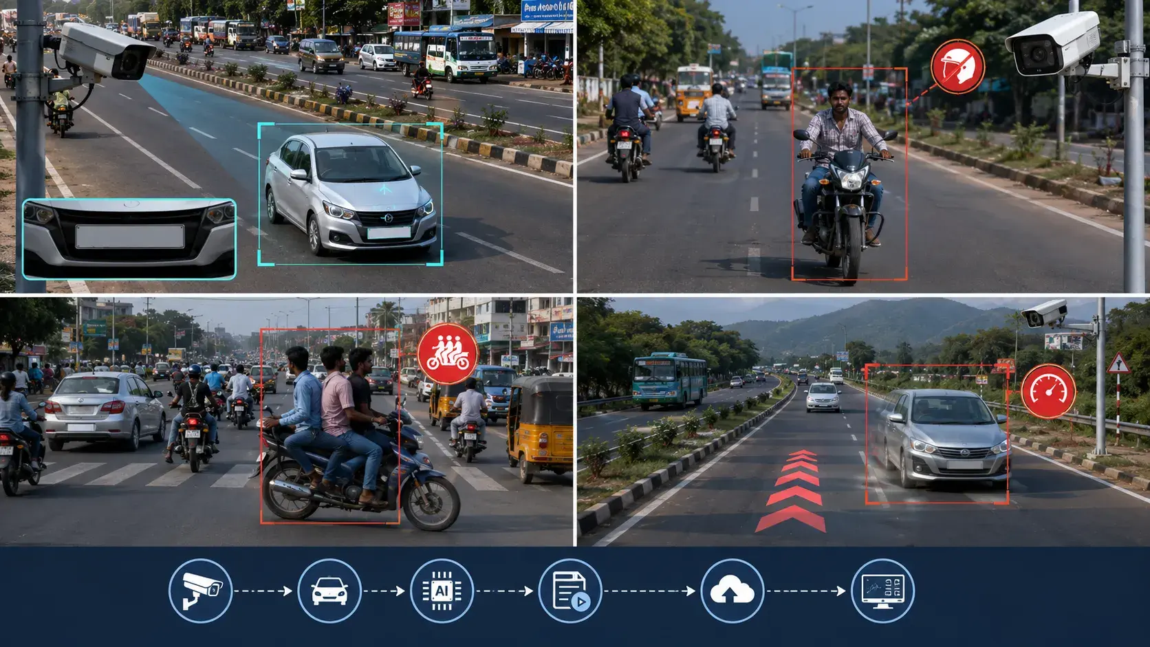
Different AI analytics were configured according to camera location, road conditions and monitoring requirements.
1. Overspeeding Detection
Sectional speed measurement was used to calculate the average speed of vehicles across defined road sections and generate alerts when vehicles exceeded configured limits.
2. Wrong-Way Driving Detection
The system identified vehicles moving against the permitted traffic direction within configured road areas.
3. No-Helmet Detection
AI analytics detected two-wheeler riders travelling without the required protective helmet.
4. Triple-Riding Detection
The system identified motorcycles carrying more than the permitted number of riders.
5. Seatbelt Violation Detection
Cameras positioned for suitable vehicle visibility supported the detection of drivers or passengers not wearing seatbelts.
6. Mobile-Phone Usage Detection
The analytics system could identify drivers using mobile phones while operating a vehicle where camera positioning and image quality supported the detection.
7. Lane Violation Detection
Virtual road zones and lane rules were used to detect vehicles entering restricted lanes or moving outside permitted traffic paths.
8. Illegal Parking and Stopping
The system detected vehicles remaining within configured no-parking or restricted stopping areas beyond the permitted duration.
Not every detection needed to run on every camera. Analytics were applied according to each camera’s purpose, viewing angle and traffic environment.
Road Incident Detection
- The Traffic Management System also supported the identification of events that could affect traffic flow and road safety.
- These included:
- 1Road accidents
- 2Stopped vehicles
- 3Vehicle breakdowns
- 4Traffic congestion
- 5Road obstructions
- 6Unusual vehicle movement
- 7Sudden changes in traffic flow
- 8Vehicles remaining stationary in restricted areas
When an incident was detected, operators could verify the event using live or recorded video and coordinate an appropriate response. Faster incident visibility helped reduce the delay between an event occurring and the monitoring team becoming aware of it.
Vehicle Detection, Counting and Classification
- In addition to violations and incidents, the platform provided traffic intelligence through vehicle detection and classification.
- The system could detect and categorize vehicles into relevant groups, such as:
- 1Two-wheelers
- 2Cars
- 3Auto-rickshaws
- 4Light commercial vehicles
- 5Buses
- 6Trucks
- 7Heavy commercial vehicles
Vehicle counting provided visibility into traffic movement across selected junctions and road sections.
The collected information could support:
- 1Entry and exit vehicle counts
- 2Direction-based traffic analysis
- 3Vehicle category distribution
- 4Traffic density monitoring
- 5Peak traffic period identification
- 6Junction movement analysis
- 7Long-term traffic planning
This data helped move traffic monitoring beyond video surveillance by providing measurable insights into road usage.
Centralized Video Monitoring
- All 33 cameras were connected to a centralized traffic monitoring environment.
- Operators could access:
- 1Live camera feeds
- 2Recorded video
- 3AI-generated alerts
- 4ANPR records
- 5Vehicle search results
- 6Speed violation events
- 7Traffic incident evidence
- 8Camera health information
- 9Event reports
Centralized monitoring removed the need to operate individual cameras through separate systems.
Operators could review multiple locations from a single interface, switch between live and recorded footage and verify detected events using supporting evidence.
This provided consistent monitoring across Theni Bus Stand, the District Collectorate, Cumbum Bypass Junction, Vilakku Junction, Gandhi Statue Junction, Annaji Junction, Thappukundu Junction, Vadugapatti Junction and Chinnamanur Junction.
Evidence and Event Management
- For every detected violation or incident, the platform maintained available supporting evidence.
- Depending on the event type, the evidence could include:
- 1Vehicle overview image
- 2Number plate crop
- 3Event snapshot
- 4Recorded video clip
- 5Camera location
- 6Detection date and time
- 7Vehicle category
- 8Direction of movement
- 9Entry and exit timestamps
- 10Measured average speed
- 11Configured speed limit
- 12Event verification status
This created a structured workflow for reviewing, verifying and retrieving traffic events.
Instead of manually searching through hours of recorded video, operators could locate relevant incidents using filters such as date, time, location, vehicle number or detection category.
Project Implementation Method
The Theni Traffic Management System was implemented through a structured process.
1. Road and Site Assessment
The project team assessed the road corridor, traffic patterns, junction layouts and required monitoring outcomes.
2. Camera Planning
Camera positions were selected based on road visibility, vehicle direction, number plate capture, traffic density and analytics requirements.
3. Network and Platform Integration
The 33 cameras were connected to the centralized Intelligent Traffic Management System and video monitoring platform.
4. Analytics Configuration
Each camera was assigned appropriate detection rules based on its location and intended purpose.
5. ANPR and Speed Calibration
ANPR camera angles, capture zones and sectional speed measurement points were configured and validated.
6. System Testing
The implementation was tested for video quality, number plate recognition, vehicle matching, speed calculation, alert generation, event recording and centralized access.
7. Operational Monitoring Setup
Live feeds, recorded video, alerts, vehicle records and reports were made available through the centralized monitoring system.
Project Outcomes
- The Theni deployment improved traffic visibility and monitoring capabilities across the approximately 40 km road corridor.
- The solution provided:
- 1Centralized access to 33 traffic cameras
- 2Automated traffic violation detection
- 3Sectional speed monitoring across defined road stretches
- 4Searchable vehicle and number plate records
- 5Faster identification of road incidents
- 6Better visibility into traffic flow and congestion
- 7Vehicle counting and classification
- 8Organized evidence for event verification
- 9Reduced dependence on continuous manual observation
- 10Improved access to live and recorded traffic footage
- 11A scalable platform for future traffic monitoring expansion
The project shifted traffic surveillance from passive recording to proactive, event-driven monitoring. Traffic operators gained access to AI-generated alerts and structured vehicle information while still retaining the ability to review live and historical video.
Another Intelligent Traffic Management Project by Katomaran
- Katomaran Technologies has also implemented an AI-powered Traffic Management System for a 10.1 km elevated flyover corridor in Coimbatore.
- The Coimbatore flyover project includes centralized traffic monitoring, AI violation analytics, number plate recognition, section speed technology and real-time incident visibility across an important urban road infrastructure corridor.
- Explore our Coimbatore flyover Traffic Management System case study to understand how intelligent video analytics were applied in another large-scale traffic monitoring project.
- These implementations demonstrate how Katomaran's ITMS can be adapted to different road environments, including district road corridors, busy junctions, bypass routes and urban flyovers.
Conclusion
- The Theni district project demonstrates how AI-powered video analytics can improve traffic visibility across a large and distributed road network.
- By integrating 33 cameras across approximately 40 km and nine major traffic locations, Katomaran Technologies created a centralized platform for vehicle identification, traffic violation detection, incident monitoring, traffic analysis and sectional speed measurement.
- The system enabled monitoring teams to identify important events automatically, review supporting evidence and access vehicle information without depending entirely on continuous manual observation.
- By combining intelligent software, strategically positioned cameras, ANPR and sectional speed technology, the project established a scalable foundation for safer, smarter and more data-driven traffic management in Theni district.
Table of contents
Build Safer and Smarter Road Networks
Deploy an AI-powered Traffic Management System for centralized road monitoring, Automatic Number Plate Recognition, sectional speed measurement, traffic violation detection and faster incident response.
Schedule an ITMS Consultation